|
――――♦――――

Aylesbury Basin, the Waterside Theatre in the
background.
BACKGROUND
“Within the last few days Baron Nathaniel de Rothschild has died
in Paris. In his young days the Baron was a most fearless
rider, and not to be stopped by any fence so long as his horse could
go. The Vale of Aylesbury was then a rough country indeed, and
was not gated as at present, nor was there a bridge over every
brook. But Baron Nathaniel cared nothing for falls, and twice
in one season he swam the canal between Tring and Aylesbury.”
Bailey’s Magazine of Sports and Pastimes, Vol. 18 (1870).
IT is likely that
the Baron retains the world record for completing that particular
swim in whatever time he took ― whether he got out at the locks
or was locked through by the family retainers is unrecorded.
|
 |
|
Narrow boats in Aylesbury Basin.
The former power station is in the background. |
In 1792, the canal engineer James Barnes [1]
surveyed a route for a canal that was
to connect Braunston on the Oxford Canal in Northamptonshire, to
Brentford on the Thames. With little change the route
he surveyed is that followed by the Grand Junction Canal (GJC) today
(since 1929, the southern section of the Grand Union Canal).
Following
completion of the survey and its publication, investors flocked to
sink their money into the project, for this was the age of
“canal
mania” and it was perceived that there were big profits to be made
from any new canal scheme; in the case of the
Grand Junction Canal Company (GJCC) this was so, until the
coming of the railways in the 1840s, when this new and quicker form
of transport captured much of its business.
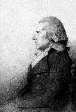
A general committee was quickly formed from among the
scheme’s subscribers under the chairmanship of the banker, William Praed
(1747–1833). Having obtained an Act of
Parliament authorising them to build the Canal,
“The Company of Proprietors of the Grand Junction Canal”
(as the Act described them) pressed
ahead with its construction together with surveys for a number
of branch canals that were intended to connect the main line with
important towns that lay in its vicinity. In later years the
Company obtained Acts of Parliament
to build some of these branch canals, but
the schemes only proceeded after much debate, or not at all, for what appeared at first
sight to be an attractive business proposition looked much less so when the
water requirement and its supply had been investigated, the scheme’s
opponents had made their objections known, and a
cost-benefit analysis had been weighed against the GJCC’s burgeoning
financial commitments elsewhere. [2]
|
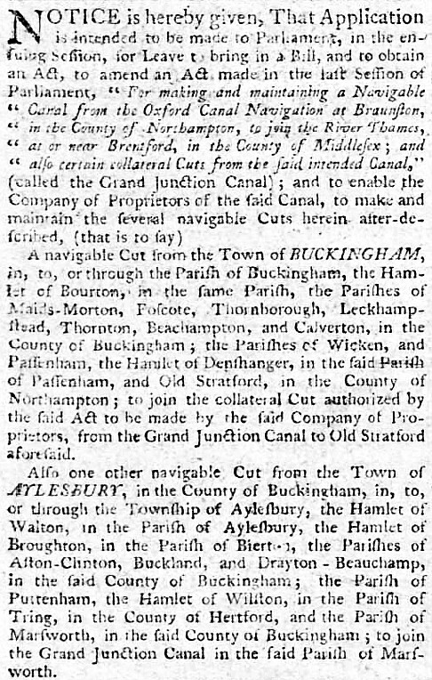
The statutory notice announcing the
GJCC’s intention to apply for an Act to build the
Aylesbury Arm ― the advertisement also dealt with the
Wendover and Buckingham branches and the proposed
branches to Dunstable and St Albans.
Northampton Mercury, 14th
September 1793. |
As early as 1793, a branch canal to Aylesbury had been surveyed and the
land owners that were to be affected by the proposed scheme approached to establish whether
they would be prepared to accept the Company’s offer to purchase. Evidence later
given by William Jessop (the GJC project’s Chief Engineer) and Acton Chaplin (the GJCC’s Clerk) before a
parliamentary committee suggests that the Company was, at that time,
intent on building several branches, including that to Aylesbury:
“William Jessop, Esquire, being examined, said, That the
Petitioners are now proceeding to make the said Canal, agreeable to
the Powers vested in them by the said Act. That by Levels and
Surveys, lately made, it appears practicable to make certain
Navigable Cuts from the several Towns of Buckingham, Aylesbury, and
Wendover, in the County of Buckingham, and also from the Town of
Saint Alban, in the County of Hertford, to join and communicate with
the said Grand Junction Canal and Collateral Cuts, or some of them.
Acton Chaplin, Esquire, One of the principal Agents to the said
Grand Junction Company, being examined, said, That the said Company
are willing, at their own Expense, to make and maintain the said
several Navigable Cuts.”
Journal of the House of Commons, Vol. 40, (1794).
The Aylesbury Arm did eventually come into being, but only after a
long and difficult gestation and then without the significance of
being the first section of a grand plan to link the GJC main line at
Marsworth and the Wilts & Berks canal at Abingdon (and then onwards to
the Somerset coalfields). The Arm was to remain a cul-de-sac,
but one that
did enjoy some prosperity in its early days. However, in 1838 work began on
building the Aylesbury to Cheddington branch railway (some of the
sleepers for which were shipped by canal to Cheddington and Broughton
wharves), which
ran more-or-less parallel to the canal to make a connection with the London & North Western Railway’s main
line. Following its completion in 1839, the Cheddington Branch gradually drew away much of the canal’s traffic.
But, ironically, it was the railway that was to
disappear in 1964,
a victim of the Beeching Axe, while the Aylesbury Arm managed to
struggle on into the age of leisure boating and survival. In 2007,
British Waterways sold the canal basin to Aylesbury Vale District Council,
and today it forms the focus of a multi-million pound waterside
redevelopment; Aylesbury High Street Station, terminus of the
Arm’s erstwhile competitor, now lies beneath shops.
――――♦――――
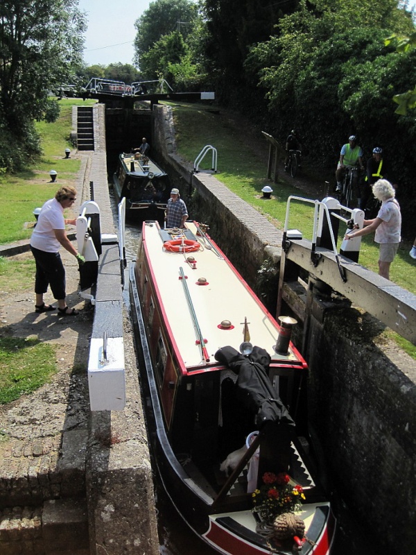
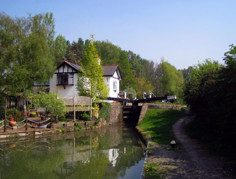
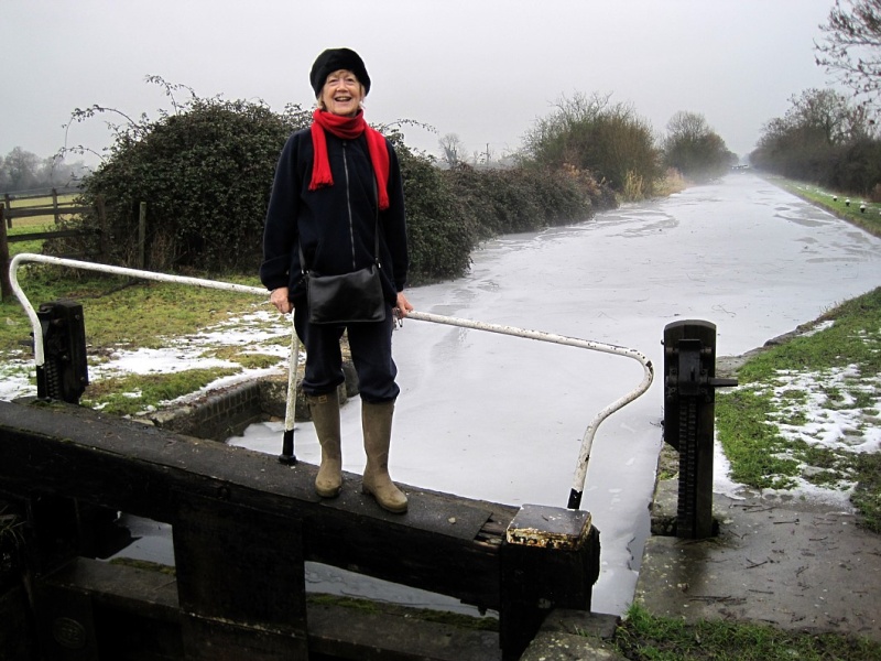
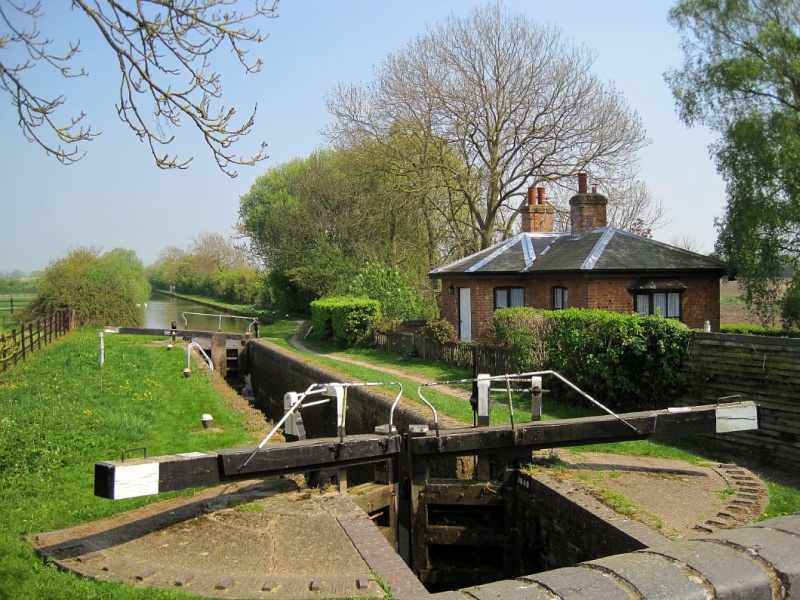
Marsworth staircase locks. Unlike the main line, the locks
on the Arm are narrow
(i.e. 7ft compared with 14ft).
One of a number of English Heritage ‘listed’ structures of the
Aylesbury Arm . . . .
Locks 1 and 2 Grand Union Canal Aylesbury Arm
GRADE II
Date Listed: 15 October 1984
English Heritage Building ID: 42091
|
“Narrow
double lock at entrance to Aylesbury arm. 1811-14. Brick retaining
walls, the lower lock with brick coping, the upper lock with stone
coping. 2 flights of brick steps on N. side. E. end of upper lock
has single gate with sluice, winding gear and quoins dated 1878. 2
other pairs of narrow gates with sluices, the centre gates with quoints dated 18?6. 5 cast iron bollards.” |
|
Sales
by Auction
――――
BUCKS
A Capital and Commodious
FREEHOLD WHARF, IN FULL TRADE,
Immediately adjoining the Grand Junction Canal and the
High Road at Marsworth, in the county of Bucks.
By GLENISTER and
KNIGHT.
At the ROSE and CROWN
INN, Tring, Herts, on Wednesday
the 19th September, at Three o’clock in the afternoon,
comprising
AN excellent DWELLING
-HOUSE, and Grocer’s
Shop, Warehouse, Stabling for 18 horses, and other
convenient Buildings, brick-built and slated and in sub-
stantial repair. The whole Let at an annual Rent
of £60
and possession of which will be given at Michaelmas
next.
Particulars may be had at Griffin’s, Green Man and
Still,
Oxford-street, London; at the Inns in the neighbouring
towns; of Mr. Giles Willis, solicitor; and of the AUC-
TIONEERS, Tring; also of Mr.
Gregory, Marsworth, who
will show the premises. |
The Bucks Chronicle, 8th September, 1821.
――――♦――――
WATER
SUPPLY AND CONSTRUCTION
CONSTRUCTION
of the Aylesbury Arm was authorised under the second GJC Act (1794), but
because the main line had yet to reach the planned junction at
Marsworth, nothing further was done. When, in 1800, the main line
did reach Marsworth, the GJCC declined to commence work on the Arm.
There was probably two reasons for the Company’s reluctance. First, the cost of building the
main line was running well over budget and the Company was having problems
enough raising sufficient capital to complete it without the added
expense of a branch canal. Second, there was difficulty in
providing this section of the main line with sufficient water
without adding a branch that would increase demand on the limited
supplies (the fall from
Marsworth Junction to Aylesbury Basin is almost 95 feet). But
regardless of the GJCC’s problems, the
citizens of Aylesbury continued to press for a canal to compete
with nearby Wendover, where a
branch had been open for trade since
c. 1799.
To placate the townspeople, the GJCC offered them an alternative to
a canal and by September, 1800, their Clerk was at work on a notice
inviting subscriptions to a £5,000 loan with which to commence “the
immediate prosecution of the works for making an Iron Rail-Road from
the said canal to the Town of Aylesbury”. The rate of interest
on the loan was
to be 5%, with £20 per cent to be paid on acceptance.
The railway, had it been built, would have been
horse-drawn. Such a line was already in use between Stoke
Bruerne and Blisworth, where it bridged the
gap in the canal caused by the excavation of the Blisworth
Tunnel having to be abandoned through severe flooding. It seems that the appeal
was successful, the Marquis of Buckingham and the GJCC Clerk, Acton
Chaplin, being among the subscribers. On 15th December 1802,
Barnes (the GJCC’s Resident Engineer) wrote to Chaplin to apologise
for missing an appointment; he then went on to say that he intended
to visit shortly “and determine to the best of my
knowledge, whether it will be best to have a Canal or Rail Road to
Aylesbury.” The decision taken was to build the “Rail Road”,
which was cheaper to construct and offered the
advantage of not drawing water from the main line, at the
time in comparatively short supply. Although the rails were
bought, they were used instead to assist in
building the canal embankment across the Great Ouse at Wolverton.
In June 1803, at a meeting chaired by William Praed, Barnes, Holland
and Barker (the latter two being surveyors) were instructed to
provide the Committee with a plan and estimate for “the intended
navigable cut from Marsworth to Aylesbury”. Nothing constructive
appears to have been done, for by October 1805 the subscribers to the rail road loan
were seeking legal advice on obtaining a writ of mandamus against
the GJCC. The opinion they received from counsel was that this strategy would
be difficult to achieve, and so a different approach for
obtaining a remedy was adopted, that of applying for an Act of Parliament
(the scheme for a railway seems, by now, to have been abandoned). The
following notice then appeared in the official newspaper of record:
“NOTICE is hereby given, that Application
is intended to be made to Parliament in the next Session for Leave
to bring in a Bill, and to obtain an Act, to require and compel the
Company of Proprietors of the Grand Junction Canal to take such
Steps as shall be necessary and proper for beginning, carrying on,
and completing a Collateral Cut from the Town of Aylesbury, in the
County of Buckingham, to join the Grand Junction Canal in the Parish
of Marsworth, in the said County, under and according to the
Provisions and Powers of the Act of Parliament, made and passed in
the Thirty-fourth Year of the Reign of His present Majesty . . . .”
London Gazette, 2nd September 1806.
The bill also required the GJCC to cease paying dividends until they
had set aside the sum they
had agreed to expend on the Arm, this being £20,256. This
tactic
must also have failed,
for nothing further is heard of it.
In 1810, yet a further approach to obtaining a remedy emerged, that
of petitioning Parliament:
“The want of water has hitherto prevented the Grand Junction from
completing a cut to Aylesbury, and occasioned a petition from the
Marquis of Buckingham, which was presented to the House of Commons,
on the first of March last, requesting no further extensions might
be granted to the Grand Junction, till that Company shall have
fulfilled their engagements with Parliament, by making a collateral
cut to Aylesbury.”
Two Reports of the Commissioners of the Thames Navigation, 29th
December, 1810.
However, by then progress on the Aylesbury Arm had become of keen
interest to others beyond the town, including the above-mentioned
Commissioners of the Thames Navigation. Their interest stemmed from
the completion in that year of the Wilts & Berks Canal, which linked
the Kennet and Avon Canal near Melksham to the River Thames at
Abingdon. In order
to reach London, traffic from the Wilts & Berks needed to use the
Thames, a river in which navigation was difficult in the upper
reaches while its sinuous path provided a lengthy route to the
capital. And so an alternative waterway was planned, to be named the
Western Junction Canal. This was to extend from Abington to
Aylesbury (36 miles) where it would connect with the planned
Aylesbury Arm to provide a link to the GJC main line at Marsworth.
By this means, so the canal’s advocates claimed, the journey from
Abingdon to Brentford would be shortened by 14 miles and made over a more
reliable waterway.
“It is notorious to all of you that the Navigation of the Thames,
from Lechlade to Oxford, is not only tedious at all times, and very
expensive, but, frequently impassable for months together; in Summer
for want of Water, and in Winter from Floods, in consequence of
which, and the enormous expense of its navigation, your supply of
Coal, Stone, and other articles cannot be brought to you nearly upon
such easy and cheap terms as they would be if Canal Communications
were effected . . . . In respect of the proposed WESTERN
JUNCTION CANAL, there
can be no possible doubt of its great PUBLIC UTILITY
and the advantages that will result from it to you,―for should it
take place the COALS brought up the WILTS
and BERKS CANAL will go as far as THAME
at least, which will operate as a useful check on the Oxford Canal
Company, and keep down the price for your benefit, and which,
without competition, will be increased upon you, without any means
on your part to prevent it . . . .”
Jackson’s Oxford Journal,
26th January, 1811.
An extract from one of the many advertisements
supporting the proposed Western Junction Canal. Probably just
as many opposed it.
|
.jpg) |
|
Jackson’s Oxford Journal, 6th
September, 1828.
The final attempt to ‘float’ the
WESTERN
JUNCTION CANAL. |
During 1810 and the early part of 1811, a flurry of notices appeared
in the press in which the proposed Western Junction’s advocates and
detractors pleaded their cases, potential investors were canvassed
and public meetings were announced. At the head of the opposition
were the Thames Commissioners, who saw the Western Junction
diverting trade, and hence their revenue, away from the Thames
between Abingdon and London. The opposing forces were finely
balanced, but when the Bill went before Parliament in 1811, the
detractors prevailed and it was defeated by a majority of ten. [3]
But by then the prospects of the Marquis of Buckingham’s
petition forestalling the GJCC’s ambitions elsewhere succeeded in bringing
about a settlement, with the Company finally agreeing to build the
Aylesbury Arm. The solution to the water supply problem was resolved by a
proposal to construct new reservoir capacity, this being provided
for in a further Act of Parliament:
“The Company to make a reservoir of at least 15 million cubic
feet of water at or near the summit level, for supplying water which
formerly flowed into the Thame, from Wendover etc. within three
years of the Act, and to send down 15 million cubic feet between May
10th and October 30th each year into the Thame. Reservoir may
be discharged into the Aylesbury Arm and supply the Thame through
it. A superintendant to be appointed to see that the water is
not used for any other purpose. If the regular passage of
boats along the Aylesbury Arm provides the requisite flow of 600,000
cubic feet per week, the duties of the Superintendant may cease.”
52 Geo. III, C.140: Royal Assent 9th June, 1812.
Work commenced on Tringford Reservoir in 1814, followed by Startops
(pronounced “Starrups”) End Reservoir at Marsworth a year later.
They were completed by 1817, both taking surplus water from the
Tring Summit (supplied mainly from the Wendover Stream). In
the meantime, Henry Provis Snr. was appointed the scheme’s Engineer
and in August, 1811, work commenced on the new canal at Aylesbury and at
Marsworth. Two years later, Provis was able to report that some two
thirds of the distance had been cut, eleven of the locks and ten of
the bridges had been completed and work was progressing
elsewhere.
In July, 1813, a sale by auction was advertised of “improvable land
contiguous to and at the termination of the collateral cut from the
Grand Junction Canal to Aylesbury . . . . extremely desirable for
the erection of wharfs, warehouses and buildings.” The ground
plan that accompanied the advertisement shows the canal terminating
in Aylesbury at Walton Street, but without any indication of the layout of what
would later become Aylesbury Basin. Potential buyers were
alerted that “These lots are sold subject to the power of the GRAND JUNCTION
CANAL COMPANY to purchase sufficient
Ground for the forming of
Wharfs, &c. in case the Owner or Owners shall neglect to do so on
Twelve Months Notice. . . .” which suggests that Aylesbury Basin,
with its once extensive wharfs and warehouses was probably not built
until some time after the Arm had opened. When exactly the opening
took place is unclear; some sources give 1815, but local historian
and onetime Editor of the Bucks Advertiser, Robert Gibbs, states
that:
“The Aylesbury Branch canal was finished in the spring of 1814,
and opened in the month of March in that year, a year noted for its
intense and prolonged frost. . . . The construction of the canal was
an event of great importance to Aylesbury; its opening was the
occasion of a general half-holiday amongst the townsfolk. This
branch not only connects the town by a waterway with other towns in
the district, but by the Grand Junction forms a link with London and
with other canals in the North. By this new source Aylesbury
obtained what it never before possessed, viz., means for the
transport of heavy merchandise to and from all parts of the
country.”
Buckinghamshire: A History of Aylesbury, Robert Gibbs (1885).
And so the Aylesbury Arm was completed, but at an unexpected cost to
the GJCC shareholders who, for the half year ending 31st March,
1816, received no dividend:
“. . . . for the following reasons, viz. . . . . to complete Two
Reservoirs forming on the Tring Summit . . . . and also to discharge
bills for completing the Canals to Aylesbury and Northampton . . .
.”
Circular to GJCC shareholders, 13th June 1816.
Much to his chagrin, Henry Provis’s work on the Arm was
criticised and he was forced to ask the Company to have the canal
inspected by a competent but independent person to exonerate his
professional reputation. The “inspector”
turned out to be none less than Thomas Telford, who in his report
stated that “. . . . upon the whole this
branch of Canal is at present in a very perfect state and will, he
had no doubt, answer its intended purpose. . . .” It might be
coincidence, but Telford was later to employ Provis’s sons John and
William [4] on some of his major projects, including the Holyhead trunk
road.
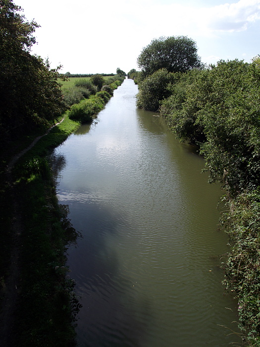
Unlike its lockless and meandering neighbour, the
Wendover Arm, the
Aylesbury Arm follows a
fairly straight and declining path to its destination. Commencing at Marsworth
Junction, 45ft below the Tring
summit, the Arm falls 94ft 8ins during its 6¼-mile journey, negotiates 16
narrow (7ft wide) locks ― the first two at Marsworth forming the
only staircase on the original GJC system [5]
― and passes 20 bridges, all but
one still being in their original condition. There is only one winding hole,
which is located to the
west of College Road Bridge (No. 9).
The Arm is supplied with water from three sources:
-
(principally) the Marsworth Pound via lock No. 1, over the head
gate weirs;
-
Wilstone Reservoir, via the sluice on Gudgeon Brook; and
-
Draytonmead Brook.
Much of this water is from Wendover via the Tring Summit and
Wilstone Reservoir. The three outflows from the Arm are over:
-
a weir into Draytonmead Brook near Merrymead Farm;
-
the offside (opposite the towpath) bank of the canal in the two
mile pound
between College Road and Broughton Lane, and
-
a weir into California Brook at Aylesbury Basin . . . .
. . . . all water eventually entering the River Thame.
――――♦――――
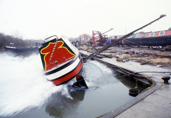
Black Jack’s lock (No. 4).
――――♦――――
THE COMMERCIAL CANAL.
“Among the general improvements which have rapidly followed each
other in modern days, the conveyance of goods and merchandise, by a
branch of the Grand Junction Canal from the principal trunk at
Marsworth to Walton, and the more recent completion of the line of
railway communication, are said to have materially contributed to
advance the benefits of all classes here, and effected a highly
favourable change in the manners and habits of the people.”
The History and Antiquities of Buckingham, George Lipscomb (1847).
FOLLOWING its opening, the Arm became well used. Although there were
wharfs along it, trade
centred on Aylesbury Basin where (in common with other towns on or
near a canal) coal prices fell dramatically, from 2s.6d. to 1s.3d.
per cwt. Other commodities discharged in the early years included
the usual timber and building materials, while exports were
predominantly agricultural. Barge-loads of emigrants destined for
the Americas via Liverpool, and soldiers and convicts being
transported to the coast from Aylesbury also used the canal; this
particular trade was later taken over by the Cheddington branch
railway and, so far as paupers for the colonies was concerned, with
the enthusiastic support of workhouse superintendents it flourished.
It is unclear how many wharfs lay along the Arm. Until 1917 at
least, there
was a coal wharf at Wilstone operated by W. F. Jeffery, but it was
not secured and local folklore has it that pilferage led to its
abandonment. There is also evidence of wharfs at “Red House”,
servicing Aston Clinton (until the late 19th century, also served by Buckland Wharf on the
Wendover Arm) and at Broughton. In addition to established wharfs,
agricultural produce, such as hay and straw, was probably loaded
into barges from accommodation bridges while manure, lime and “sweepings” were discharged between barge and canal bank over planks.
Looking west from Bridge No. 6.
During the nineteenth century, the population of Aylesbury began to
grow in line with the general drift from countryside to town. Indeed,
better transport communications helped attract businesses to the
town, a number of which made use of the canal. The book printer
Hazel, Watson and Viney moved to Aylesbury in 1867, and a decade
later was employing 200 people. The company used the canal to transport
straw board. The Aylesbury Condensed Milk Company (later
the Anglo-Swiss Condensed Milk Company and Nestlés) established a
canal-side factory in 1870. They started with a workforce of twenty
and a decade later were employing fifty, mainly young women involved
in filling, sealing, labelling and packing tins of condensed milk:
“The filled tins are now transferred to the packing-room, where
they are neatly labelled and wrapped in paper. Boxes, all
exactly of the same size, are prepared on the premises, and in them
the tins are packed, ready for delivery; these packages are passed
down a shoot from the upper part of the premises to the Company’s
wharf, and quickly conveyed to the barge lying in the canal to
receive them.”
Buckinghamshire: A History of Aylesbury, Robert Gibbs (1885).
In 1891, the old Walton water mill on the Bear Brook was bought by
flour millers Hills and Partridge, who erected new buildings on the
site. The firm had their own wharf and much of their raw materials
and produce arrived and departed by canal. Canal transport was also
the reason for siting the town’s electricity works, timber yard and
the all-important coal yard at the canal basin. However, more sustained
railway competition came in 1892 with the Metropolitan and, in 1899,
with the Great Central railways. Activity on the Arm diminished
still further after WWI with the growth of road transport, which by
then was also making inroads into railway
business.
AYLESBURY ARM
At Marsworth junction is a branch of the canal connecting the main
line with the town of Aylesbury, the distance from the junction to
the town being 6¾ miles. At Aylesbury are to be found numerous
firms taking advantage of canal transport. Coal is taken to
the Electricity Works, as well as to other premises and, in
addition, timber, grain, wire, building materials, and straw board
are dealt with. Mr. A. Harvey Taylor, canal carrier, has his
wharf at this point.
Grand Union Canal Company advertising material, c.
1938.
By WWII, trade on the Arm had become sporadic,
although the hostilities provided a brief revival ― aluminium ingots were carried by canal from London to International
Alloys for casting into billets before being sent by canal to Birmingham for use in the manufacture of aero-engine cylinder blocks.
Following WWII, canal traffic in general fell into serious decline. Little money was spent on maintenance and in tune with this the Arm
deteriorated rapidly. Data published in the Rusholme Report [6]
illustrates the extent to which trade had declined by the early
1950s; none is recorded as having originated on the
Arm in any of the three years analysed in the Report, while income
and expenditure were recorded as follows:
|
ANALYSIS OF INCOME 1951, 1952 & 1953 |
|
YEAR |
Tolls
& dues
£ |
Water
rents
£ |
Other
rents
£ |
Misc.
£ |
TOTAL
RECEIPTS
£ |
|
1951 |
50 |
43 |
867 |
5 |
965 |
|
1952 |
22 |
43 |
859 |
4 |
928 |
|
1953 |
11 |
43 |
848 |
4 |
906 |
|
ANALYSIS
OF EXPENDITURE
1951, 1952 & 1953 |
|
YEAR |
Locks &
Lock gates
£ |
Canal &
river banks
£ |
Bridges &
tunnels
£ |
Buildings
let to
tenants
£ |
Other
buildings
£ |
Motor
vehicles
£ |
Plant &
machinery
£ |
Misc.
£ |
Engineering
admin.
£ |
TOTAL
EXPENDITURE
£ |
|
1951 |
131 |
532 |
15 |
4 |
48 |
1 |
- |
1 |
274 |
1,006 |
|
1952 |
16 |
919 |
16 |
25 |
2 |
11 |
1 |
61 |
218 |
1,269 |
|
1953 |
24 |
793 |
65 |
15 |
- |
1 |
1 |
70 |
231 |
1,200 |
. . . . in other words, canal carrying was earning next to nothing,
and overall the Arm was losing money. Against this background
― and that of numerous other waterways that shared the Arm’s
loss-making capacity ― it is unsurprising that Rusholme recommended
[7] that:
(iii) the [British
Transport] Commission concentrate on those
waterway activities which are of real value as part of the transport
system and to be relieved of the remainder, which are placing a
heavy burden on the waterways administration and finances;
(iv) certain defined waterways are to be developed, others are
to be retained for navigation and the remainder are to be regarded
as having insufficient commercial prospects to justify retention for
that purpose.
In 1959, the Arm gained a reprieve from permanent closure
when a new boat hire company set up business in Aylesbury
Basin. A brief diversification into coal and timber carrying resulted in a
limited amount of dredging, but overall it was a losing battle.
――――♦――――
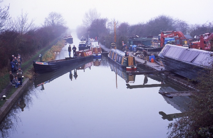
The sole remaining
business on the Arm is
Jem
Bates’ boatyard at Puttenham.
Following nationalisation in 1948, control of inland waterways was
vested in the gargantuan and lethargic British Transport Commission.
Under the Transport Act, 1962, the Commission was replaced by five
successor bodies of which the British Waterways Board (BW)
took over the management of the inland waterways. An early
task for the Commission was to reshape national waterways policy,
particularly as it affected canals, which were making a considerable
loss,[8] some
being in derelict condition. Thus, BW set about a comprehensive
review of their estate to establish the facts.
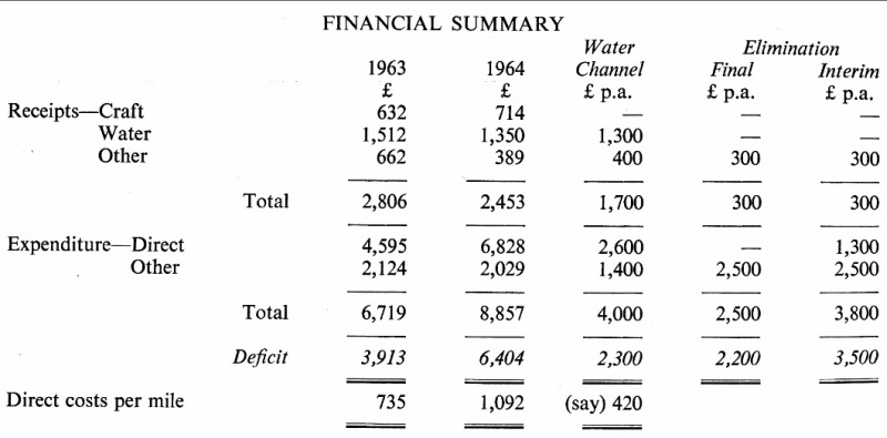
The figures that appeared in the section of their published report [9]
dealing with the Aylesbury Arm [App.]
reveal that in the decade following Rusholme (see above), receipts had grown substantially but so had
expenditure, resulting in a higher annual deficit: £3,913 for 1963
(£2,930 at 1953 values based on the RPI), and £6,404 for 1964
(£4,800 at 1954 values based on the RPI). Perhaps more
interesting is the value that BW placed on converting the Arm to a
water channel [10]
― about £2,300 p.a. ― and of eliminating the waterway
entirely [11]
― £3,500 p.a. reducing to £2,200 p.a.
Fortunately, BW took no immediate action to implement the thrust of
their findings, for the Board recognised that new and wider
implications had by now to be taken into account before any decision
about a waterway’s future could be reached:
“As far as the wider aspects of waterways problems are concerned,
it has been impressed upon us that there is a steady and rapid
growth of interest in (and perhaps anxiety about) the use of
leisure, out-door recreation and the future of the countryside.
Moreover, as will be seen, our studies have led us ― regretfully ―
to judge that there is no hope of many of the waterways balancing
income and expenditure ― at any rate for many years to come.
Clearly, therefore, the question of the future is not one that can
be resolved simply on commercial grounds; it brings in broad social
questions as well. As far as the broader questions are
concerned we realise that we form only part ― we think a unique part
― of a bigger subject, the subject of general future policy towards
recreation.
So we think we ought to make the facts generally available for
consideration by all concerned.”
The Facts About the Waterways, British
Waterways Board, London, 1965.
The 1960s proved to be the low-water mark in the Arm’s fortunes. Commercial traffic ended in 1964 with the last regular delivery of
coal, the boat hire company ceased trading and wharf-side buildings
and warehouses were demolished. Aylesbury Council expressed an
ambition to fill in the basin and, for good measure, sought to have
the entire Arm abandoned.
In 1961 the Inland Waterways Association held their National Rally
at Aylesbury Basin. It was a great success, for by then
leisure boating was beginning to become a popular pastime.
But the real change came in 1968, when Barbara Castle’s Transport
Act gave the first government recognition to the recreational value
of waterways, with a new remit for BW to develop their leisure
potential. Due to long-term underfunding, little could be done
to stem the canals’ decline and it was the work of enlightened
enthusiasts that became central
to saving and restoring many miles of the waterway network. By the
early 1980s, the number of leisure craft topped 20,000 as canals
became increasingly used for leisure purposes.
After much effort by
the Aylesbury Canal Society and other amenity bodies,
the Arm was saved, with leisure boating providing its sustaining force together with walking and fishing.
British Waterways, working with the Local Authority and countryside
bodies, have improved the waterway and its infrastructure to provide a
pleasant back door route into Aylesbury, while much redevelopment
has greatly enhanced Aylesbury Basin’s surroundings.
――――♦――――
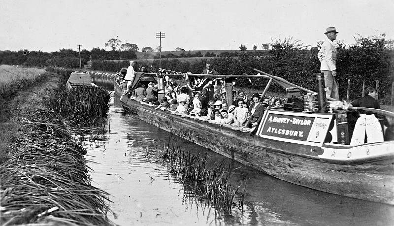
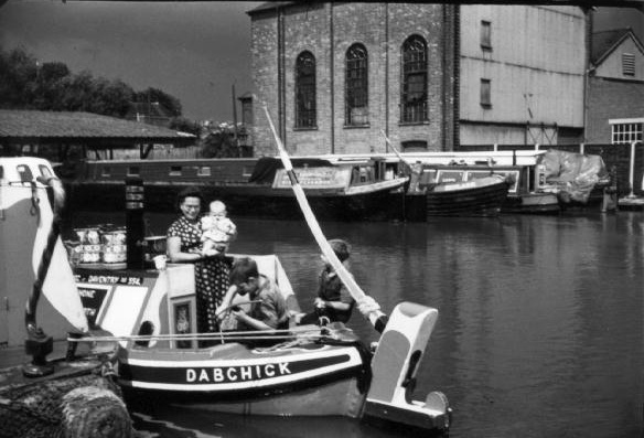
Sunday school outing in a pair of Harvey-Taylor
narrow boats, 1931.
Reproduced by kind permission of Miss Catherine Bushell.
――――♦――――
AYLESBURY-BASED CANAL CARRIERS:
THE LANDONS AND A. HARVEY-TAYLOR
THE Aylesbury firm of John Landon & Co. were coal merchants who also
ran a small fleet of horse-drawn narrow boats from the Basin;
according to a trade directory for 1852, they even operated a weekly
“fly-boat” service to London. Taken at face value, this suggests
there remained – after the railway had creamed off most of it –
sufficient high-value trade to justify an express canal service:
“CONVEYANCE BY WATER: To LONDON, William and John Landon’s Fly
Boats, from Aylesbury wharf, Walton St, every Saturday.”
Slater’s Directory, 1852.
By 1869, the Landon’s non-stop fly-boat service had been replaced by
still faster “canal
steamboats” operated by the Grand Junction Canal Carrying
Establishment, John Landon now being their agent:
“WATER CONVEYANCE. London, Birmingham, & all parts of the
kingdom, by canal steamboats; Grand Junction Canal Company; John
Landon, agent. Goods delivered in London at the ‘White Horse,’ Cripplegate,
& at 30 Wharf, City Road basin.”
Kelly’s Directory, 1869.
In 1876, the Grand Junction Carrying Establishment ceased trading. Landons
continued in the business, although no more offering a service to “Birmingham & all
parts of the kingdom”; the firm’s advertisement in Bradshaw’s Canals
and Navigable Rivers (1904) offered merely a service “between London
and Aylesbury and towns en route”. Incoming cargoes would have
supplied the various businesses around the Basin, but other than
condensed milk, the return journey would probably have depended on
anything that could be collected along the way, such as animal feed
and straw from along the Arm and perhaps building aggregates from
the
many pits below Rickmansworth.
Landon’s business was taken over in 1923 by Arthur Harvey-Taylor,
who enlarged the all-wooden fleet by having craft constructed at local boat building
yards (Costins at Berkhamsted, and Bushell Bros. at Gamnel). The
firm dominated the carrying trade on the Aylesbury Arm for some 30
years. Coal was their major business, the firm supplying amongst
other concerns Nestlé’s, the Aylesbury power station, the Aylesbury
Steam Laundry and, further afield, John Dickenson’s various
canal-side factories and that of A. Wander & Co. (makers of
Ovaltine) at Kings Langley, as well as domestic consumers. Large
customers for other goods included Mead’s Flour Mill at Gamnel Wharf
and Garside’s sand quarry at Leighton Buzzard.
|
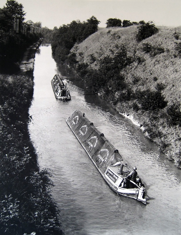
A pair of
Harvey-Taylor narrow boats in Tring Cutting. Note
the telegraph poles ― selling wayleave to
telecommunications companies provided a useful source of
revenue to canal companies from the 1860s onward.
On this section, a fibre optic highway was installed
during the 1990s. |
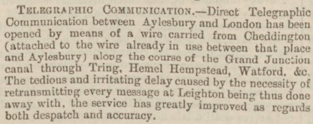
The opening of the direct Aylesbury-London telegraph service, via the GJC.
The
Bucks Herald, 23rd September, 1871.
By the beginning of WWII, the fleet had reached its greatest size,
consisting of nine pairs of boats and two spare butties. A severe
water shortage led to the closure of the Arm in 1942, and it did not
reopen fully until 1947; the closure affected Harvey-Taylor’s
regular traffic into
Aylesbury with road and rail providing alternatives. Some
compensation came from the firm’s long distance carriage of coal
from the Warwickshire coal fields to customers on the main line, such as John
Dickenson and Wander Foods, and others in the London area. But
business tailed off, the fleet gradually dispersed and the firm
ceased trading in 1955.
“Canals, as the predecessors of railways, did good service in
their day. They created internal trade, facilitated the
introduction of foreign merchandise into, and the exportation of
produce from, the interior parts of the country. To
agriculturists they were, and indeed still are, a great boon.
Manure, marl, lime, and all other bulky articles which cannot
possibly bear the great expense of cartage are by them transported
from one district to another at a very light cost; thus poor lands
are enriched, and barren lands brought into cultivation, whilst hay,
corn, and other produce can be carried to distant places at a
comparatively nominal charge.”
Buckinghamshire: A History of Aylesbury, Robert Gibbs (1885).
――――♦――――
In the bleak mid winter - at Lock No. 11 (Puttenham), looking towards Wilston.
The same location in summertime - Puttenham Bridge (Lock No. 11)
――――♦――――
APPENDIX
GRAND UNION CANAL — AYLESBURY ARM.
The Facts About the Waterways,
British Waterways Board, London, 1964.
(App. 5, p.74)
1. The Aylesbury Arm of the Grand Union Canal
descends through 16 narrow locks in its 6¼
miles from Marsworth Junction to its terminus at Aylesbury Basin.
Water supplies derive from the Tring summit supplies on the main
line, of which a large proportion have first to be pumped from the
Tring group of reservoirs into the Tring summit. There are a
number of water sales in Aylesbury. Commercial traffic is
negligible but there is a fair use by pleasure craft. The Arm
is expensive to operate and maintain — not least in terms of lockage
water — and incurs a heavy deficit in relation to its length.
2. In 1964, gross receipts were £2,453, including
£1,350 from water sales and £713 from pleasure craft. Direct
costs totalled £6,828 (£1,092 per mile). The deficit was
£6,404.
3. If the Arm were to be converted to a water
channel, direct costs would fall substantially to about £2,600 (£420
per mile) per annum, and the deficit to about £2,300 per
annum.
4. If the Arm were to be eliminated, the deficit
would be about £2,200 per annum, with an increase to about
£3,500 per annum during the interim period.
5. Clearly the present high level of deficit on this heavily-locked
short length would be greatly reduced by conversion to a water
channel. Moreover, as water sent down the Arm is lost to the
system the balance of advantage might well be in elimination on
general water conservation grounds, even though the interim period
figure is higher than the water channel one. However, a
decision between these alternatives would require careful study of
the alternatives available to the present Aylesbury users.
――――♦――――
|